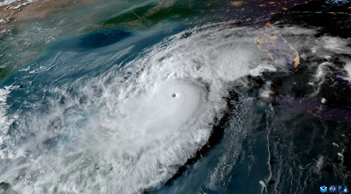
Forecast by the National Hurricane Center in Miami to reach the Big Bend of Florida as a major hurricane Wednesday morning, Hurricane Idalia reached Category 2 status earlier tonight as its outer bands sent sweeping waves of rain across Florida.
Maximum sustained winds from the system have increased to 105 mph, according to the NHC’s Hurricane Hunter aircraft, with even higher gusts. Once making landfall, it is forecast to turn toward the northeast and east-northeast, moving near or along the coasts of Georgia, South Carolina and North Carolina late Wednesday and Thursday, where tropical storm watches are already being put in effect for some areas.
Though Idalia must cross over Florida to reach the East Coast, the NHC 8 p.m. alert warned that it is “likely to still be a hurricane” when it moves across southern Georgia.
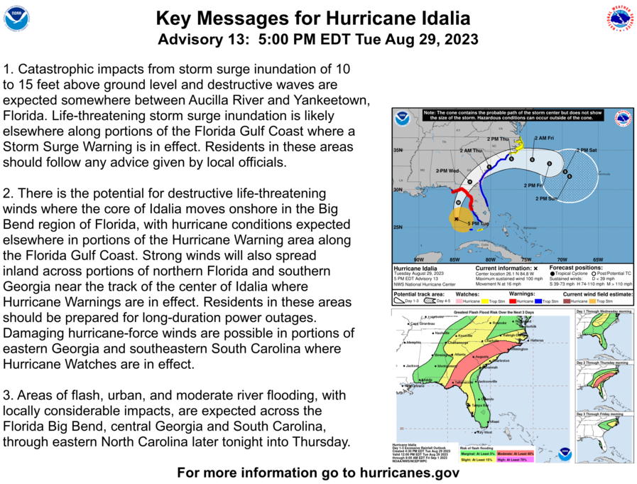
“Catastrophic impacts from storm surge inundation of 10 to 15 ft above ground level and destructive waves are expected somewhere between Aucilla River and Yankeetown, Florida,” the NHC advised in its 5 p.m. Tuesday key messages.
Battening down the hatches
The University of North Florida is completely closed the rest of Tuesday and Wednesday, except for residential students living on campus. Shuttles and dining services will also be completely closed on Wednesday unless the university communicates otherwise, UNF said during an alert Tuesday afternoon.
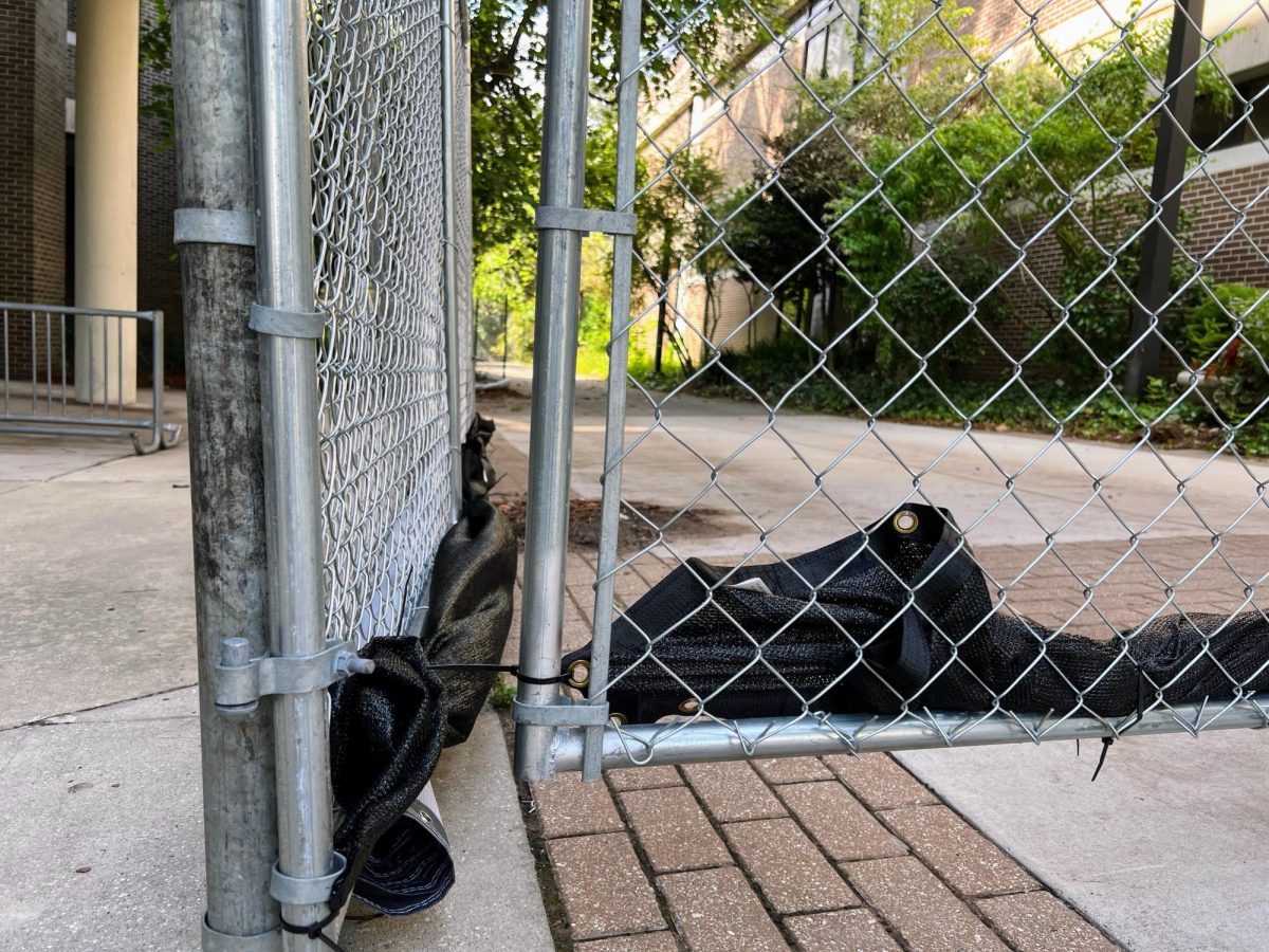
Much of the core of campus and around the Fine Arts Center has been undergoing construction in recent weeks. Materials still outside were seen zip-tied to fences that were drilled into the concrete, and bigger materials were strapped down to the ground. University Police Department barricades were stashed inside the Fine Arts Center and campus was quiet Tuesday afternoon.
“Residential students should be mindful of their personal safety and are advised to avoid any outdoor activity tomorrow,” the university said in today’s alert.
The university expects to return to normal operations on Thursday but is continuing to monitor Idalia. UNF will update the campus community on Wednesday with any updates or changes, they said.
Watches and warnings in effect
As of the 8 p.m. advisory from the NHC, the following watches and warnings are in effect. Note that these will change as the hurricane progresses. Stay updated with current watches and warnings here.
- A Storm Surge Warning is in effect for Englewood northward to Indian Pass, including Tampa Bay.
- A Hurricane Warning is in effect for Middle of Longboat Key northward to Indian Pass, including Tampa Bay.
- A Tropical Storm Warning is in effect for Dry Tortugas Florida, Chokoloskee northward to the Middle of Longboat Key, West of Indian Pass to Mexico Beach and Sebastian Inlet Florida to Surf City North Carolina.
- A Storm Surge Watch is in effect for Bonita Beach northward to Englewood, including Charlotte Harbour, Mouth of the St. Mary’s River to South Santee River South Carolina, Beaufort Inlet to Drum Inlet North Carolina, Neuse and Pamlico Rivers North Carolina.
- A Hurricane Watch is in effect for the Mouth of the St. Mary’s River to Edisto Beach South Carolina.
- A Tropical Storm Watch is in effect for Lower Florida Keys west of the west end of the Seven Mile Bridge, North of Surf City North Carolina to the North Carolina/Virginia border and Pamlico and Albemarle Sounds.
For more information about Hurricane Idalia, visit here.
Stay with Spinnaker as we bring continued updates about the storm and its impacts on Jacksonville and UNF.
___
For more information or news tips, or if you see an error in this story or have any compliments or concerns, contact editor@unfspinnaker.com.


